
Location Intelligence Widget: enhanced property listings on your website
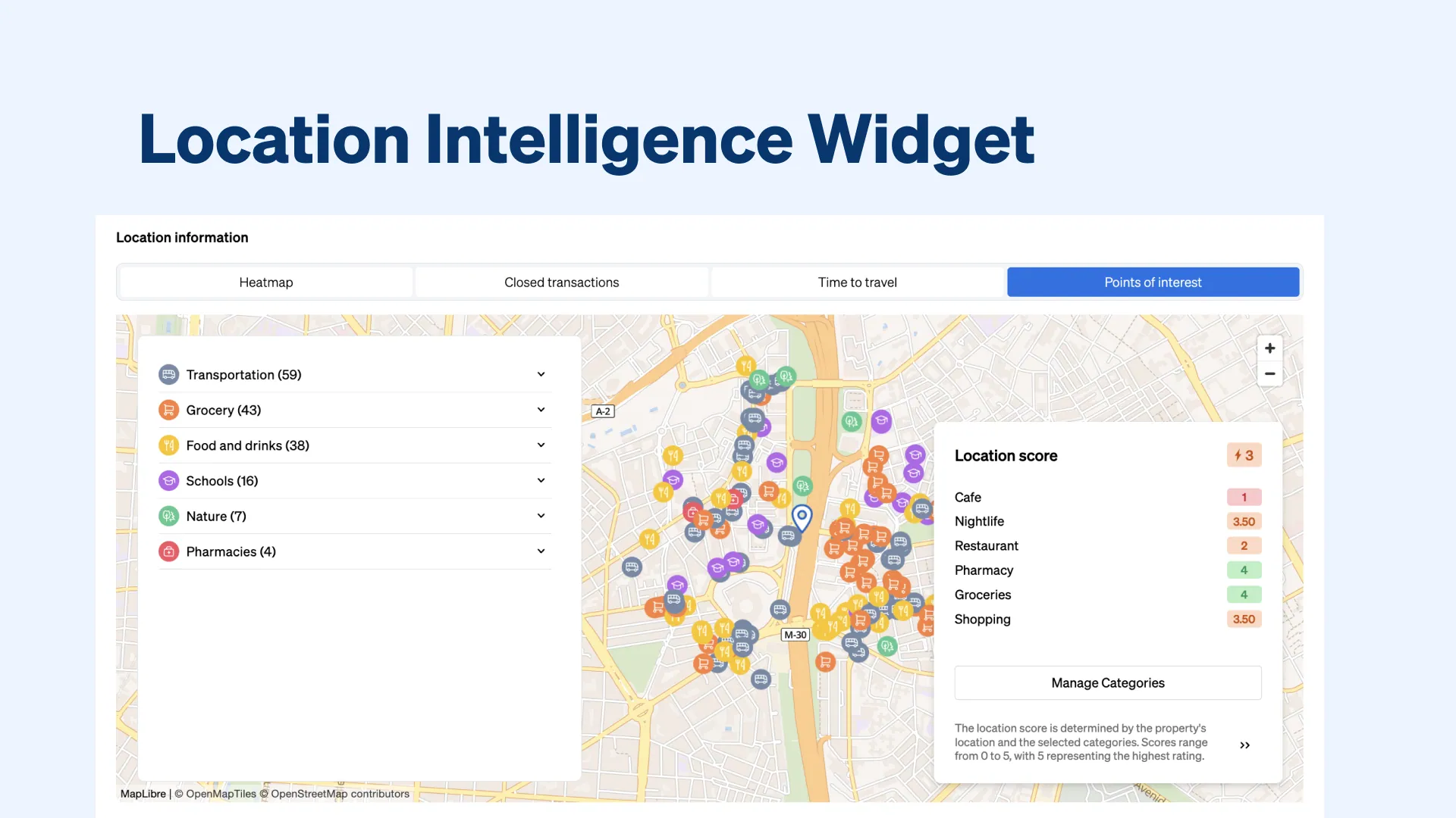
Introduced at the beginning of 2024 following the rollout of CASAFARI Property Sourcing, CASAFARI’s Location Intelligence Widget embeds into real estate websites and portals in 10 minutes via a code snippet. It enriches property listings with interactive maps of nearby points of interest, 0-to-5 location scores, commute times by transport mode, closed transactions, and neighbourhood asking-price heatmaps.
Who is the Location Intelligence Widget built for?
The Location Intelligence Widget was tailored for real estate website owners and decision-makers seeking to enhance their listings and provide valuable information to potential buyers.
This tool can also help real estate portals to differentiate themselves by offering comprehensive location insights to their audience and basically anyone with properties listed, including agencies looking to maximise the appeal of their properties.
What features does the Location Intelligence Widget add to property listings?
Our Location Intelligence widget offers a range of features designed to enhance the browsing experience and provide valuable insights to your customers:
1. Getting detailed information on amenities in the vicinities of a property
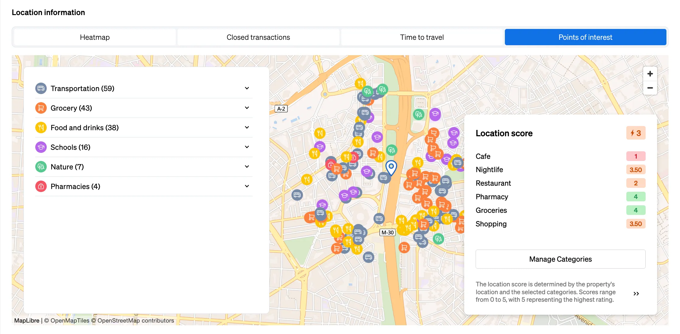
With CASAFARI’s Location Intelligence powered by Targomo, our widget provides an interactive map that allows property seekers to navigate intuitively through all points of interest around a property.
Also, each listing is enriched with a list of essential amenities and attractions, such as proximity to metro and bus stations, nearby schools and natural attractions, access to pharmacies, hospitals, supermarkets, cafes, and restaurants. Basically, it’s a full view of an area.
You can even find a location score, analysing an area in relation to different categories of amenities, with scores from 0 to 5. That way, you can understand at a glance if the property matches the buyer’s lifestyle or not.
2. Help customers understand how their daily commute will look like
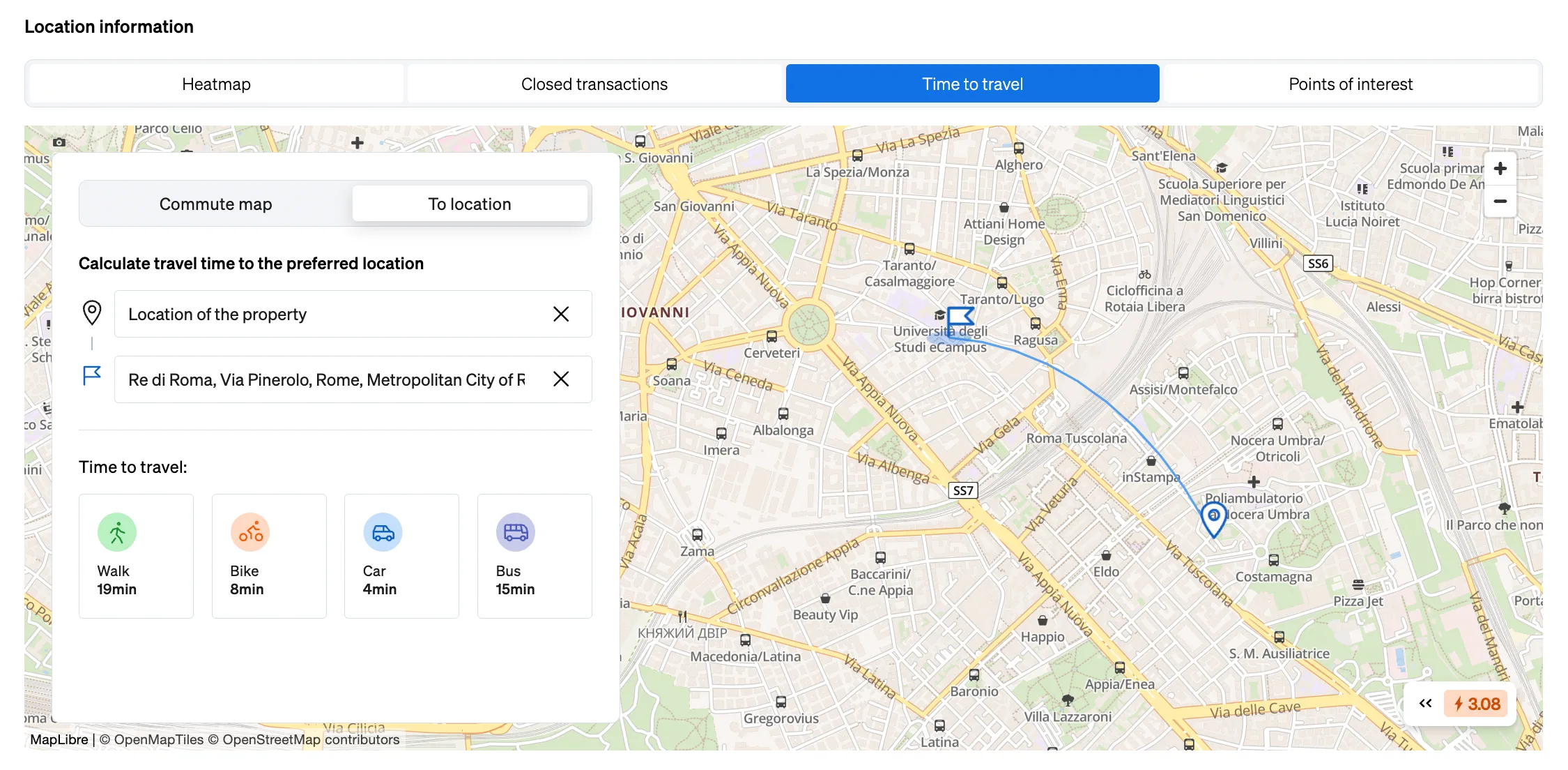
Users can easily determine the time it takes to travel to key-destinations defined by them on the go, whether the commute is by foot, bike, car or public transport.
It’s also possible to visualise reachability by foot and vehicle with heat maps, providing valuable insights into how far you can go with each transportation option and into the accessibility of an area.
3. Analysing the desirability of an area in a glance
Your customers will be able to see scores for locations based on various factors, aiding them to make informed decisions when buying, selling or renting.
4. Understanding the local market prices
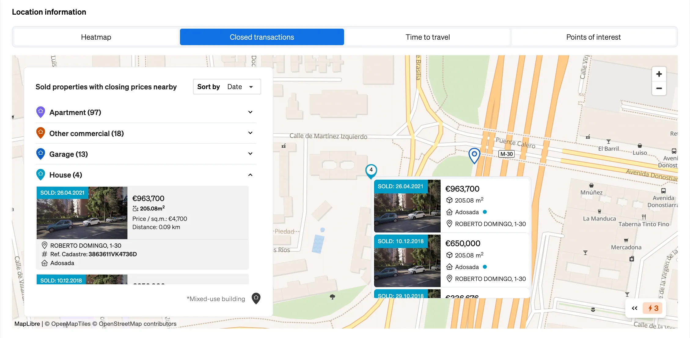
By viewing closed transactions displayed on the map, real estate agents get a fast glance at market trends and pricing dynamics in a specific area. This localised data helps agents provide accurate pricing advice to clients, set competitive listing prices, and negotiate deals more effectively, ensuring their strategies align with current market realities.
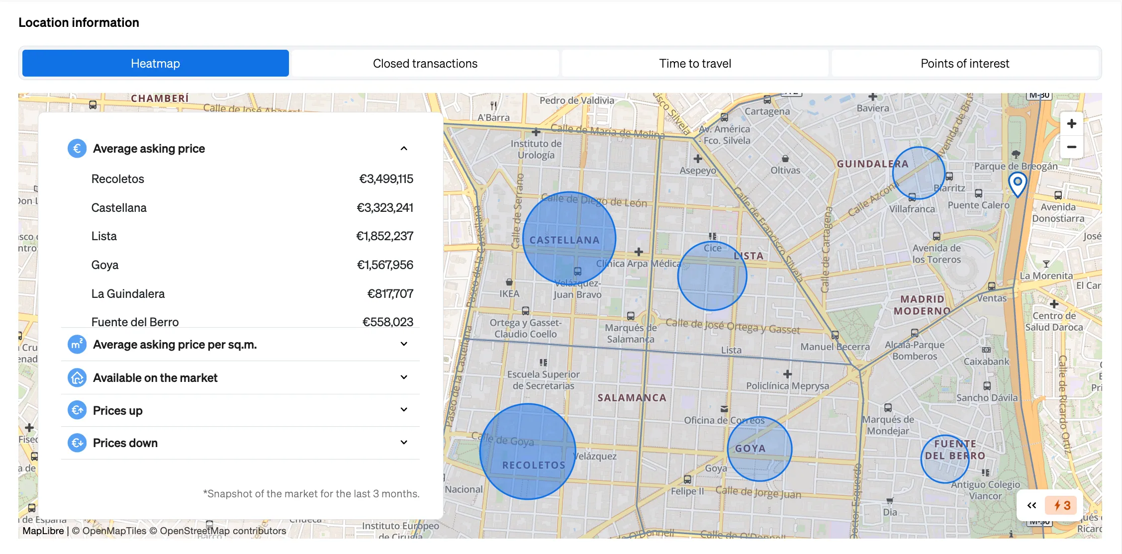
Also, in the Heatmap section, powered by data from CASAFARI Area Insights, you can see the average asking prices from indexed listings, the market stock and the increases or decreases of different areas of the neighbourhood.
5. Easily come up with compelling property descriptions with AI
Real estate professionals can also generate property and location descriptions with AI, saving time and resources while maximising the appeal of each property listing on your website.
Adding our widget to your real estate listings is quick and hassle-free. It takes just 10 minutes to embed it – integrate the snippet code – into every listing in your portfolio. And the best part is it’s a flexible solution, accessible to businesses of all sizes, no matter how many listings they have.
Frequently asked questions
What information does the CASAFARI Location Intelligence Widget display on a property listing?
The widget displays an interactive map of nearby points of interest, including schools, public transport stations, pharmacies, supermarkets, cafes, and natural attractions. It provides location scores from 0 to 5 across amenity categories, travel times, and reachability heatmaps. Additionally, it displays closed transactions and neighbourhood heatmaps of average asking prices and market stock.
How long does it take to embed the Location Intelligence Widget on a real estate website?
It takes approximately 10 minutes to embed the widget into every property listing in a portfolio by integrating a snippet code. The solution is designed to be flexible and works for real estate agencies and portals of all sizes, regardless of their listing volume.
How does the widget calculate commute times and reachability around a property?
Property seekers can define key destinations on the go and view commute times by foot, bicycle, car, or public transport. The widget also generates reachability heatmaps for foot and vehicle travel. This allows buyers and renters to see at a glance how far they can travel within specific timeframes.
What market price data is included in the Location Intelligence Widget?
The widget includes closed transactions mapped across the neighbourhood, offering clear visibility into completed historical sales. It also provides a heatmap section showing average asking prices derived from listings indexed by CASAFARI, along with market stock levels and price movements.
Can the widget help estate agents write property descriptions?
Yes, an AI-powered feature allows real estate professionals to generate compelling property and location descriptions directly. This helps save time and resources while maximising the market appeal of every listing.